We support General Contractors, Surveyors, and Engineers in converting Point Cloud Scan Data to Accurate Revit Models.

What We Do
Scan to BIM Services
Our Point Cloud Modelers import the Scanned Point Cloud Data into tools like Autodesk Revit for creating information rich 3D Models. These digital twins can be used for Design Validation, Progress Monitoring, As-Built Documentation, Demolition & Renovation Planning, Quantity Takeoff, Budget Estimation etc.
We provide Scan to BIM services for industries like oil & gas, bridges, tunnels, metro stations, historical buildings, commercial & residential buildings etc.
Architects
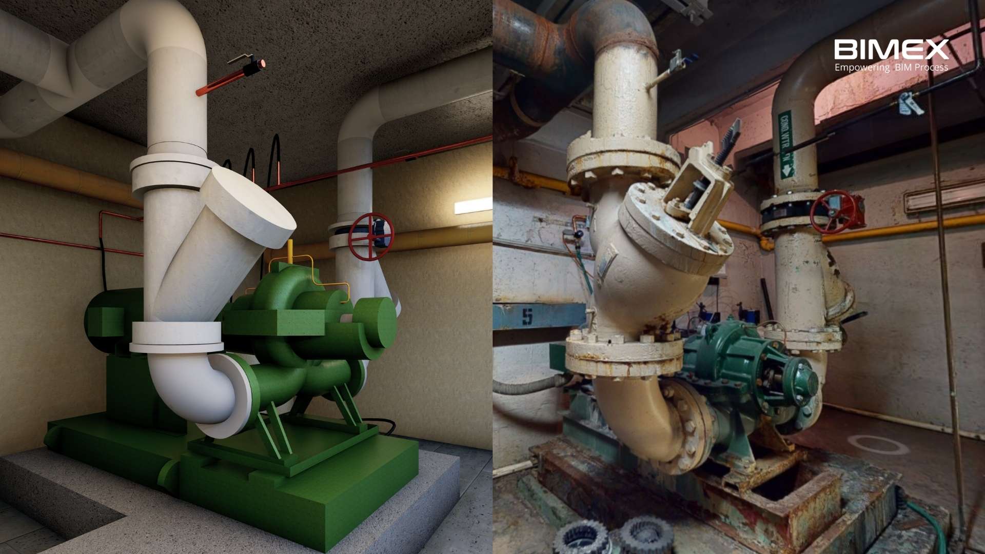
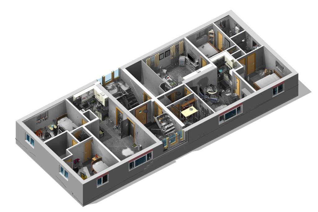
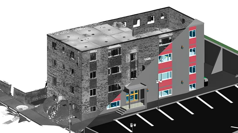
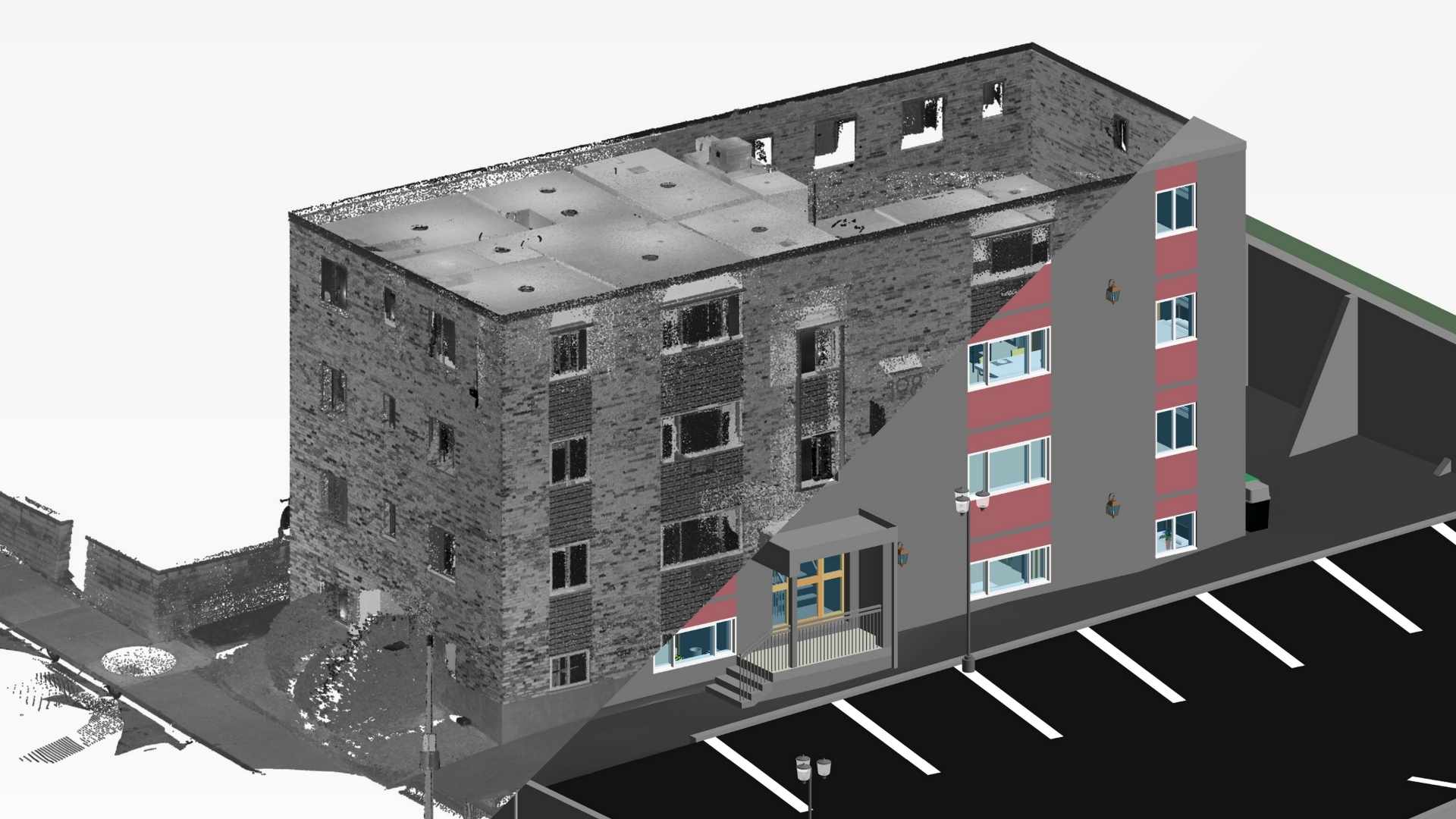
Scan to BIM provides accurate 3D models of existing structures, enabling precise design integration and reducing rework.
Surveyors
Laser-scanned data is converted into detailed BIM models, allowing for exact measurements and improved site analysis.
General Contractors
As-built models derived from Scan to BIM offer better planning and coordination, minimizing errors and on-site delays.
Asset Managers
Comprehensive BIM models support efficient facility management, offering insights for maintenance and long-term asset optimization.
Our Scope of Services
Point Cloud to
Architectural Models
Point Cloud to
Structural Models
Point Cloud to
MEP Models
Point Cloud to
Infrastructure Models

We're proud to collaborate with a diverse range of clients.
With the expertise to tackle your most challenging projects, BIMEX Engineers is committed to delivering exceptional BIM services that drive project success.
Level of Development
Our LOD
Capabilities
Experience BIMEX Engineers’ expertise in delivering precise BIM models at various stages, ensuring accuracy, Level of Detail (LOD) and Level of Information (LOI) at every stage of development, from concept to construction.

LOD 100
(Pre-Design or Concept Design)

LOD 200
(Concept Design)

LOD 300
(Design Development)

LOD 350
(Construction Documentation)

LOD 400
(Construction)

LOD 500
Why We Deliver
Our Scan to BIM
Services
Our Point Cloud Modeling deliverables include the following:
- 3D Model developed based on the required LOD
- 2D Plans, Sections & Elevations
- Site Layout Plans
- Link Asset Information to the As-built Model

Why We Deliver
Convert Point Cloud to 3D Revit Models with +/- 10 mm accuracy
We have expertise team who are capable of working in projects ranging from industrial to small scale residential projects, and on projects where the scan data is of low quality and in cases where scan files exceeds more than 100 GB. Our teams has got the engineering mindset and know-how of the construction methods makes it possible to restructure missing details based on assumptions or from reference images.
Use Cases
Scan to BIM
Use Cases
The use cases of the Point Cloud to BIM Models include the following:
- New Construction
- Renovation and Retrofit Projects
- Historical Monuments Restoration Projects
- Building Performance Analysis
- Facility Management

Why Us
What Differentiate
Us
We have worked with Point Cloud inputs from different laser scanners, including Trimble, Leica Geosystems, Faro, Matterport and Reigl scanners, to develop information rich 3d Revit Models (*.rvt). We are familiar with the conversion of *.fls, e57, *.pcg, *.obj, *.laz, *.rcs and *.ptg file types into a Revit-ready format.
Our team is proficient in developing 3d models of scanned data received from Aerial Scanners using Drones, historical monuments restoration and, infrastructure projects etc.

The Benefits
Benefits of
Point Cloud to BIM
Using BIM process allows the survey data to be transformed into 3D models in the real world. The 3D models have significant advantages at every step of a construction project, starting from the initial concept to the final handing over stage.
- Better Visualization
- Increased productivity by reducing errors
- Accurate As-Built Survey Data when compared to manual red markup’s
- Designers can integrate designs into existing built environment
- Better understanding of Planned Vs Actual Scenarios

Our Capabilities
Our Point Cloud
Modeling Capabilities
We create accurate Point Cloud Models for As-Built Updating.
Better Quality Assurance
The Point Cloud Data generated from Laser Scan can be used to compare the planned schedule and project progress without even undergoing a site inspection.
Better Planning
Better Building Analysis
Better Cost Control
The use of Scan to BIM methodology can reduce the surveying cost when compared to traditional methods. It’s considered as the most efficient and time saving method in delivering the As-built documentation.


Our Latest Project
Your Extended BIM Team
Explore our recent projects and see how BIMEX Engineers delivers exceptional results across a diverse range of sectors, from iconic stadiums to luxurious high-rises.
Testimonials
What Our Client Say
Read what our clients have to say about their experience with us.

